June 9th, 2004 Chase highlights, Weyer (Germany)
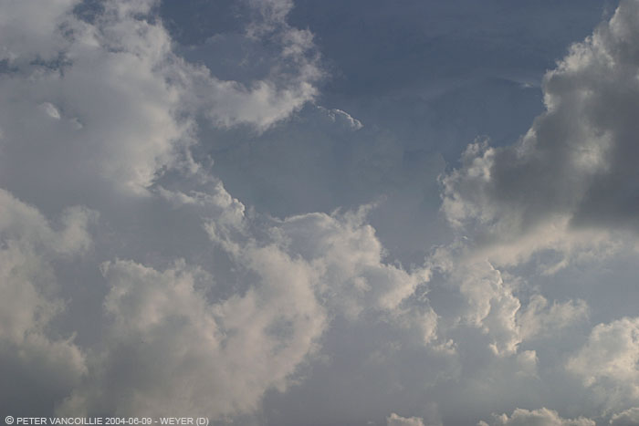
Although cape/li values were not bad, June 9th had some doubtful charts whether or not storms would develop in south-eastern Belgium, because high altitude conditions were not really favourable, but we decided to hit the road anyway. During late afternoon, we arrived near the German border where we saw continuous congestus trying to break through the cap, but without much result the first few hours, except for a few shallow showers, probably forced by geographical lifting over the 600m (2000 ft) altitude hills. It wasn't until late afternoon when we saw the first strong convection. Unfortunately, it grew too far east of us to chase it, since it was moving away from us and heading for the densely populated suburbs along the Rhine.
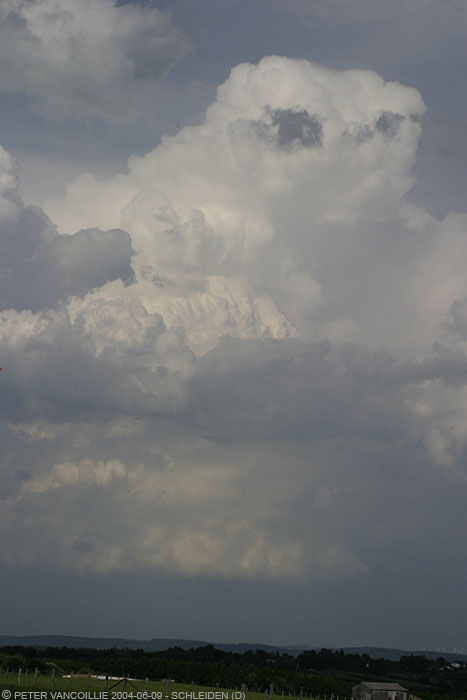
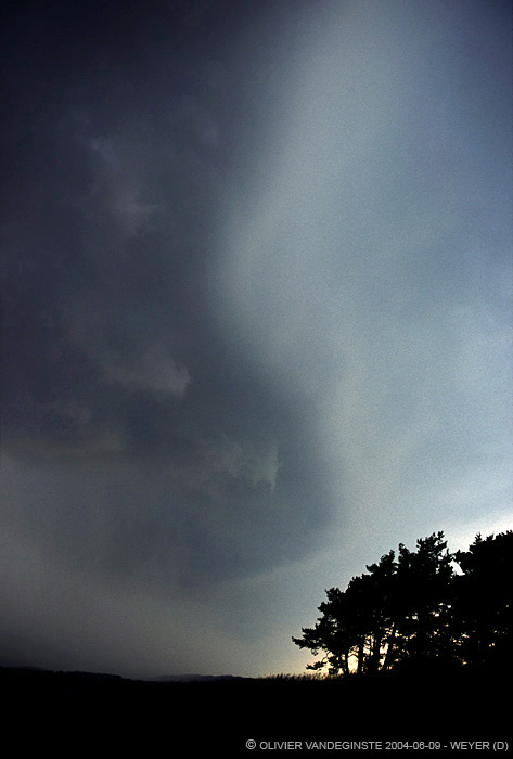
Luckily for us, later that evening a few new cells developed over the Belgian Ardennes, and these were heading straight towards us. We found a good spot with clear view towards the W and SW in Weyer, near exit 133 along highway E29 south of Euskirchen (Germany). We saw typical heat thunderstorms develop right in front of us, with quite a lot of CG's in the areas underneath the growing towers, soon followed by descending rain cores. Some of the CG's had return strokes, and I managed to capture one of them on digital camera.
Underneath is a figure of how the two already existing cells moved left and right of us, connected with a bridge of congestus that spit out a lot of CG's and rapidly grew rain cores.
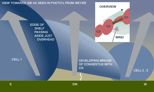
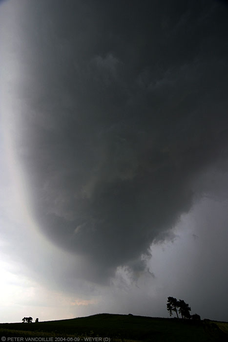
Overview and view as seen on photos
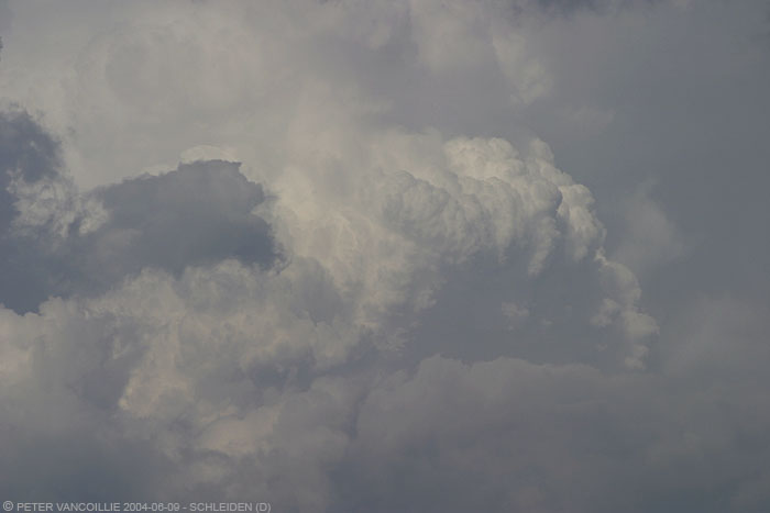
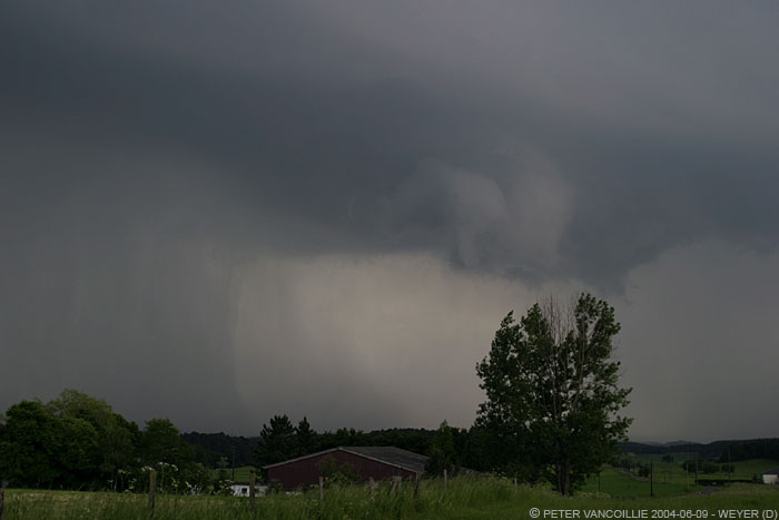
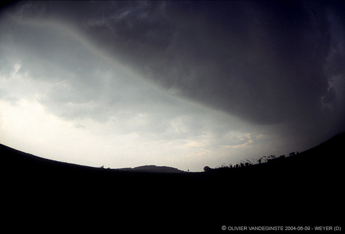
The growing congestus bridge dooms up in the shadow of the anvil of the cell further west

To your left cell 1, the 'bridge', to your right cell 2
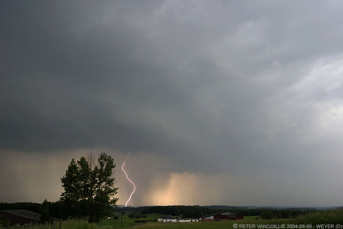
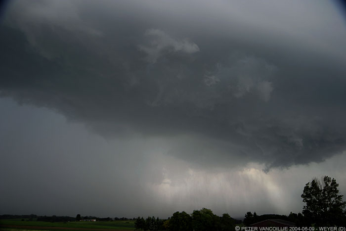
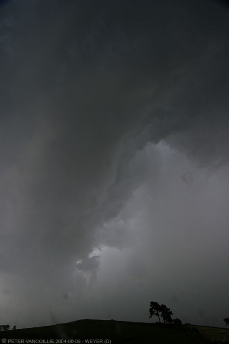
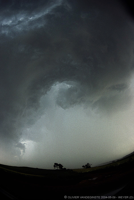
new rain cores develop in the region with multiple CG's and return stokes
of which one I was able to capture on digital camera by hand
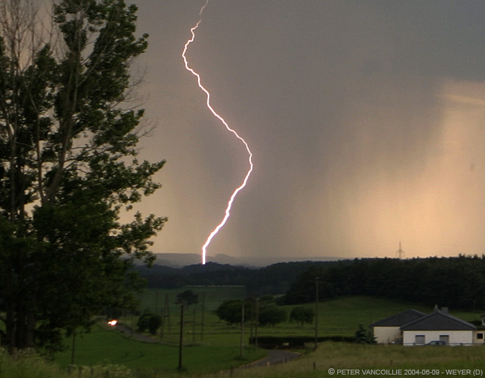
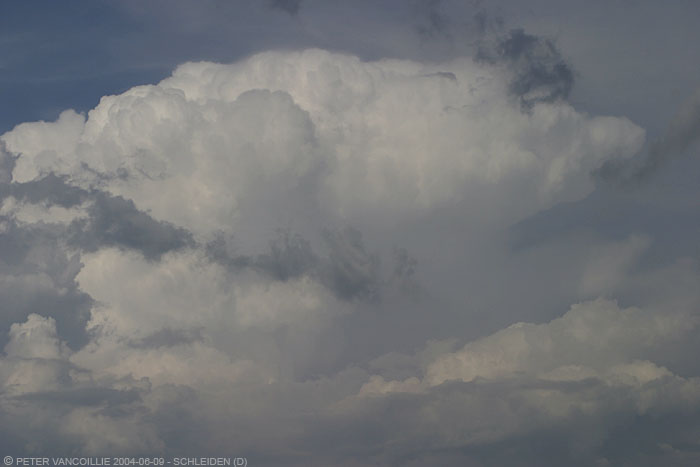
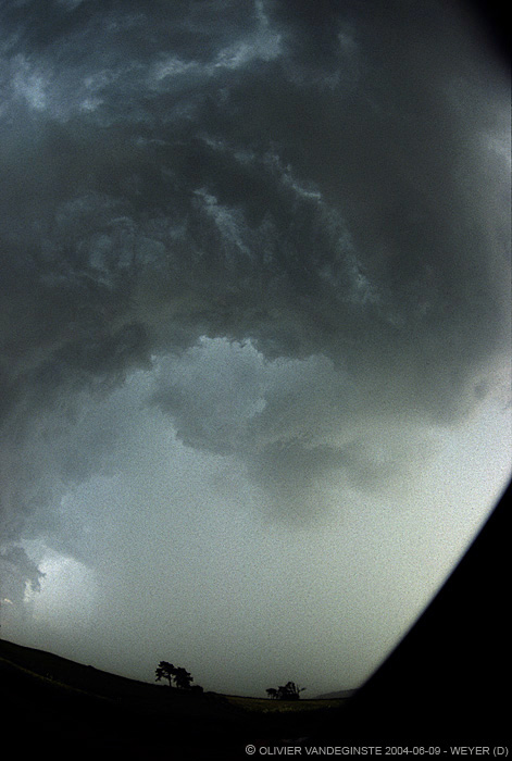
Crop of the above image, slightly smaller than true size of the original 6mp shot
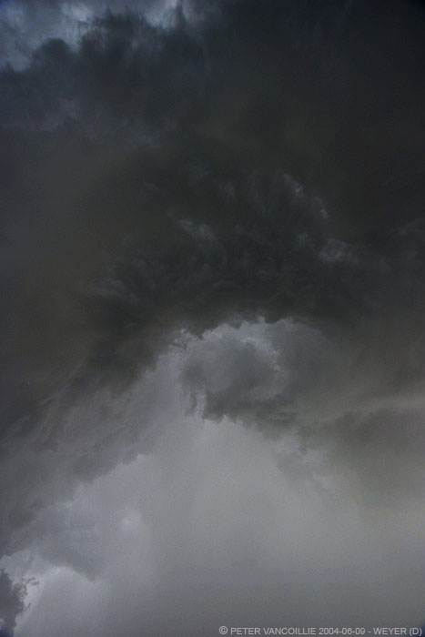
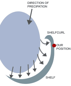
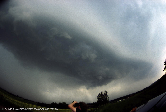
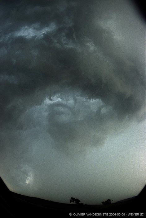
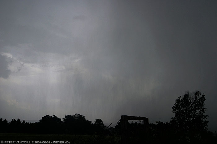
The area that was developing created a nice rain foot, but also a beautiful shelfcloud of which the edge came over but aside us without battering us with heavy rain instantly. As it came aside, some turbulences initiated some rotation, but it was short-lived and, imo, these were in no sense associated with a rotating updraft, though it looked very ominous. I've included a little figure of how I think this turbulence was formed, and this is also how it looked like: the main shelf was being pushed forward just east of us by the developing rain core. Above us, the forward progression was less prominent, and I guess that's how the cloud got curled backwards towards the raincore. Compare it to a little whirlwind sometimes made visible by leaves rotating on the ground in the wake of a car or truck passing by. I'm not 100% sure about this is what happened, but that is how it looked like and that's probably what it was. It lasted no longer than 1 minute or so. Also, using the fisheye 15mm lens and a 12mm sigma makes the curl look bigger than it actually was. Shortly after it, we got some hail up to 1cm diameter (0.4 inch or little less than marble size), and a brief downpour.
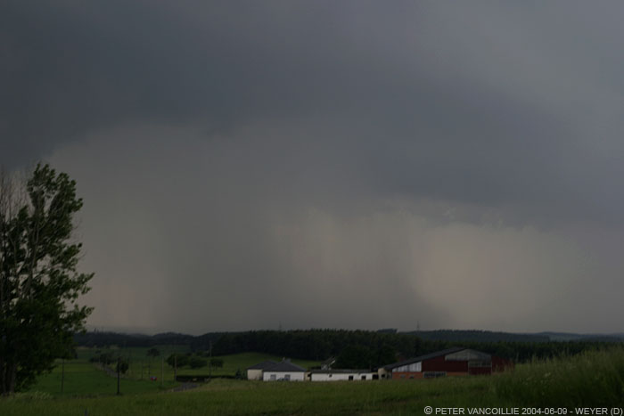
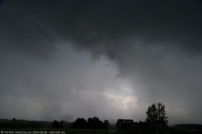
Precipitation becomes denser, and at the edge of the rain foot, scud and soon a shelf developes

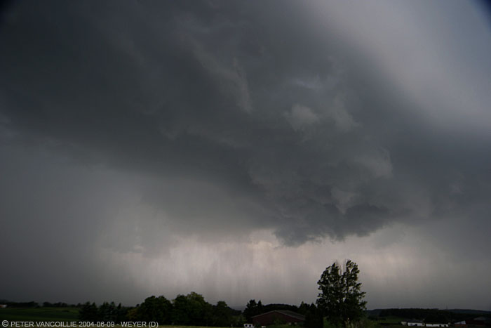
The shelf is passing just aside us, becoming a bit greenish/cyan
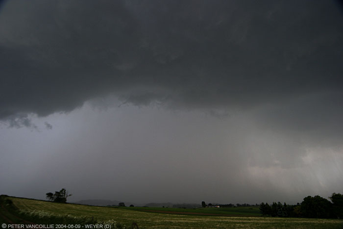
View towards the east
View towards the southwest, though the main core went just aside us,
we won't make it without getting battered
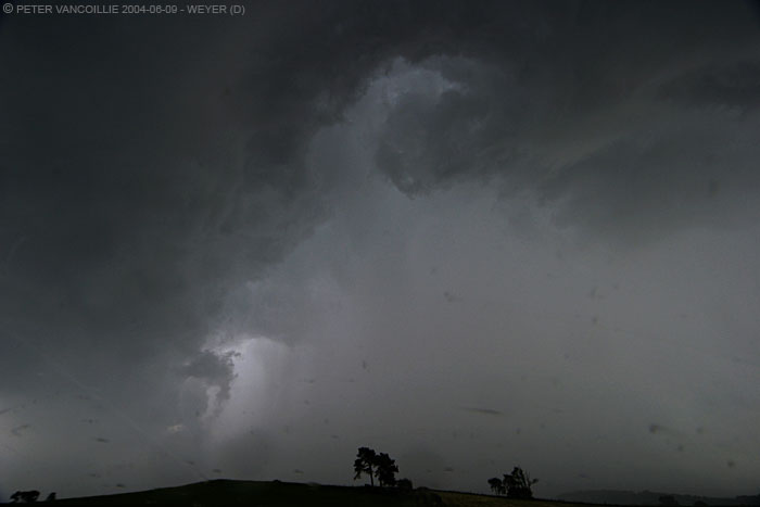
This is where the shelf develops some rotation. It looks worse than it was. I've included a little figure further below which I think explains what really happened
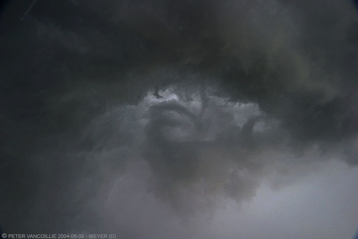
The photos above are taken with digital camera and 12-24mm sigma (rectalinear lens), beneath are the 35mm slide scans of my chase pal Olivier, taken with a 15mm Zenitar fisheye, and the figure that explains how I think this rotation developed along the shelfcloud:
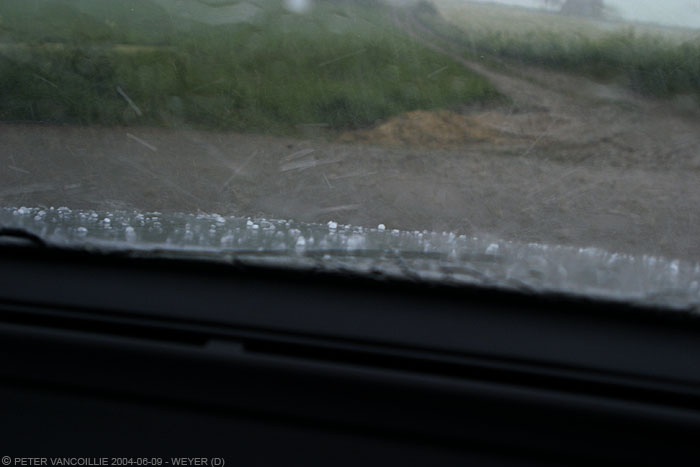
Eventually we get battered with rain and hail up to 1cm diameter
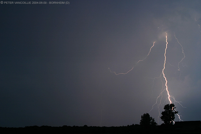
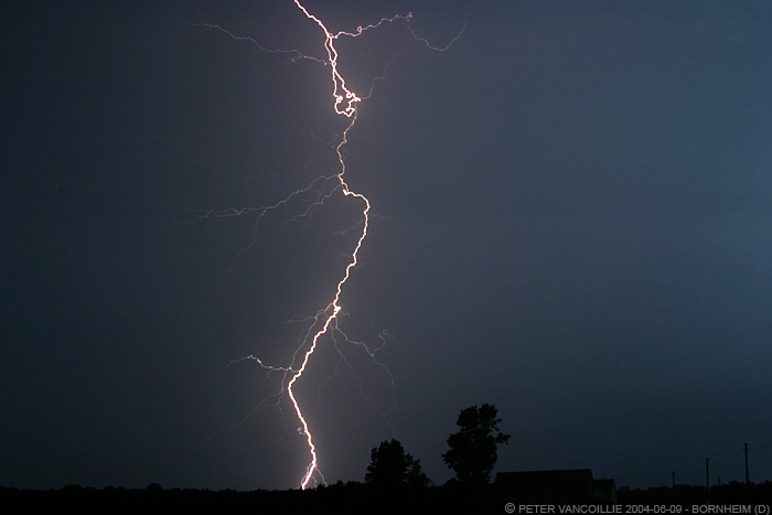
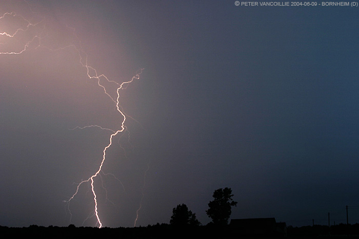
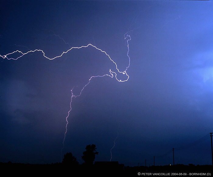
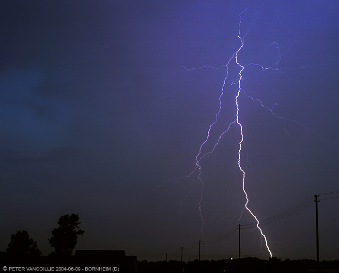
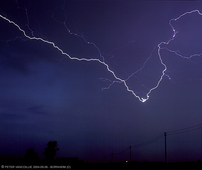
These storms were moving slowly so we decided to follow them further NE, since it didn't look like anything would develop in their trail. We saw an opportunity to shoot lightning at dark, and we were lucky again. We ended up near Bornheim (a suburb of Bonn) when it finally became dark enough to start trying lightning. The original pictures are not too much of a success, since we used too small apertures and the bolts were still too distant as it wasn't fully dark yet, but I was able to get some more out of it on my PC.
These were done digital (Canon 10D, Canon 28-105, JPEG large ISO 100):
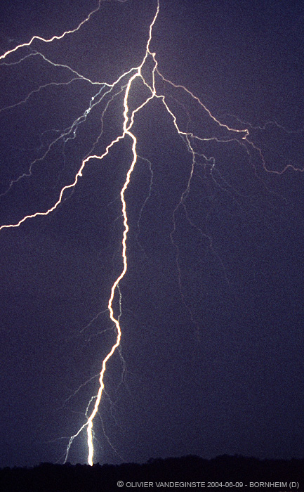
These are scans (Epson 2450 photo) from 6x7cm slides (Mamiya RB67, Mamiya 90mm, Fuji Provia 100), some are crops:
Crop, 80% of the original, see photo below for original view
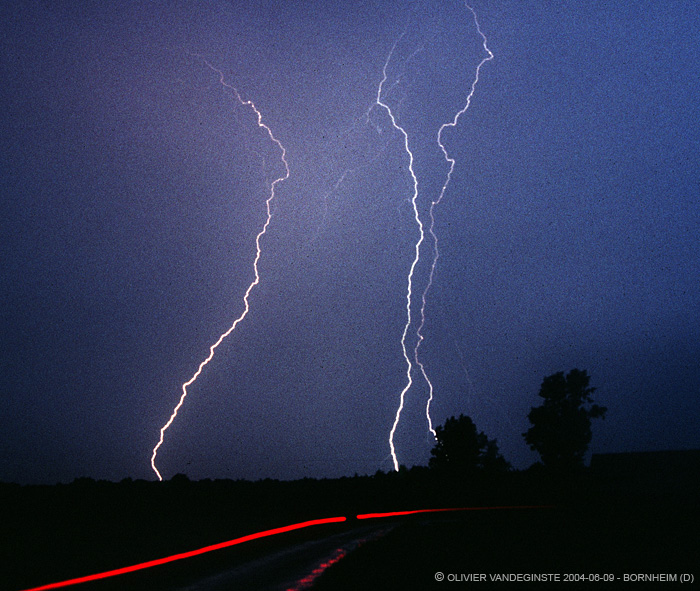
These are scans (Minolta Scan Dual III) of 35mm slides by my chase pal Olivier (canon 1v, sigma 28-105, agfa RSX 50), some are crops:

Full slide
Crop of the above original
Crop, center 70% of the original
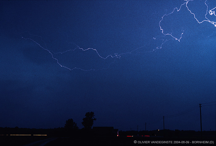
Full slide, strongly enhanced to make the crisp channels visible on monitor
We decided to spend the night in the area since conditions were going to favourable again the next day, and again we got a pretty succesful chase on June 10th!
T - Technical
- Camera: Canon Eos 10D
- Lenses: Canon EF 28-105mm F3.5-4.5
- Lenses: Canon EF 75-300mm F4.5-5.6
- Lenses: Sigma 12-24mm F4.5-5.6
- Exif headers are maintained in JPEG's from the original
- Camera: Mamiya RB67 ProS
- Lenses: Mamiya 90mm
- FUJI PROVIA ISO 100
Photo's Olivier:
- Camera: Canon Eos 1v
- Lenses: Sigma 28-105mm F2.8
- Lenses: Zenitar MF 15mm fisheye
- Agfa RSX ISO 50