June 10th, 2004 Chase highlights, Heffingen (Luxemburg)
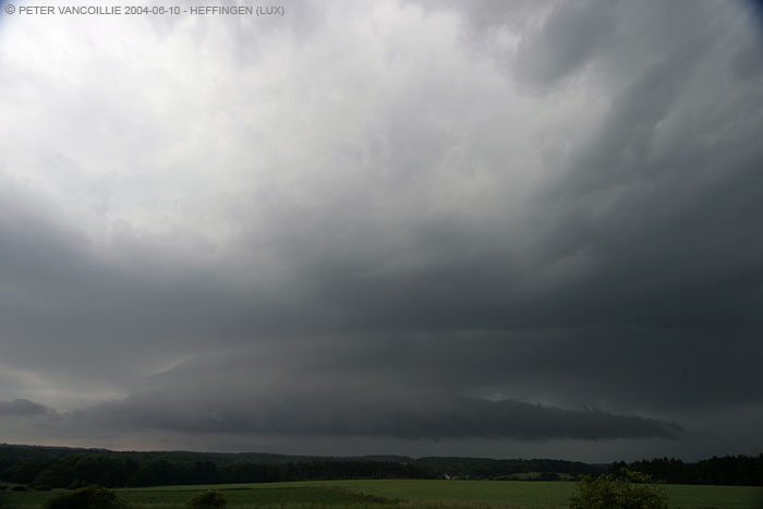
On June 10th, the next day after our previous succesful chase, conditions were favourable again further south in Luxemburg. We intercepted a large multicellular storm complex coming from France and heading northeast, with a constant inflow of new cells at its southern tip. It was quite a rush to stay out of its raincore from the anvil but the road was perfect: first south and later a little southeast, and finally we reached a town called Heffingen, south of Diekirch (LUX) where we had a clear view at the main storm's most southern edge, after driving through a mini-rain core in front of the main system:
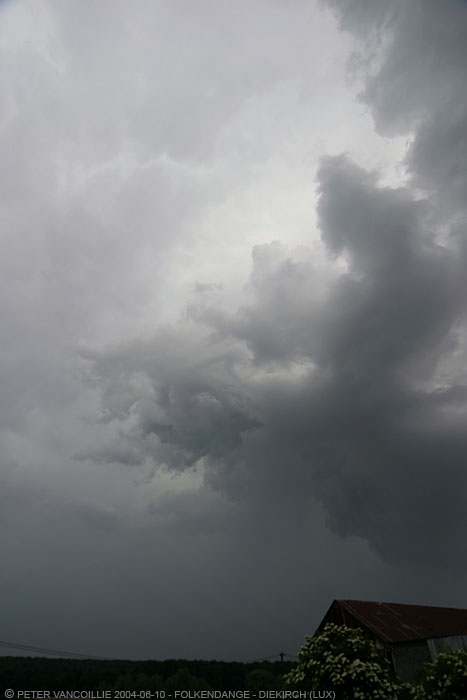
Mini T-storm with small rainshaft in front of the main storm complex (view towards northeast)
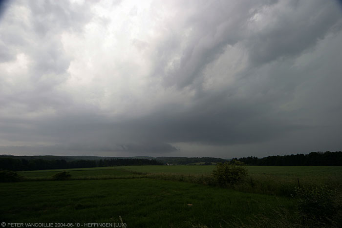
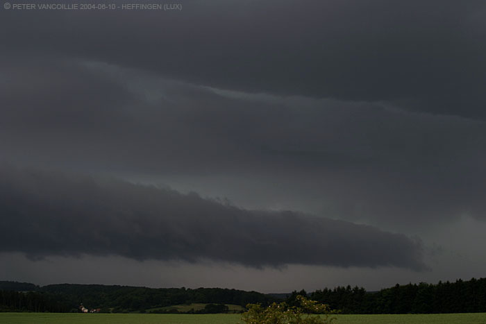
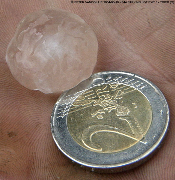
As if a show was set up especially for us: the storm behaved exactly what I was hoping for: a new segment entered the system. What started out as a small cigar-like shelf, turned into a monster shelf in less than 10 minutes, with parts turning over somewhat greenish before battering us with rain and hail up to 1.5cm (0.6 inch). We couldn't escape this baby and went south as soon the rain and hail set in, towards the highway we needed anyhow to go back home after this two day chase. Before we went west again, we followed the system a little further east on highway E44, and made our last stop on a parking lot at exit 3, Trier (Germany) of highway E44. There we found the largest hail: almost 2cm (0.8 inch) in diameter, but as you can see by the dents melted in from the grass (probably already 20 minutes or so): it originally probably had a diameter of a 2 euro coin.
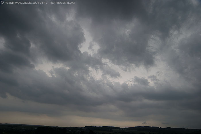
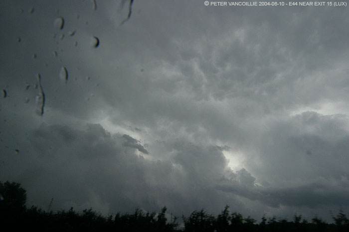
View to the south: very unstable atmosphere underneath the giant anvil
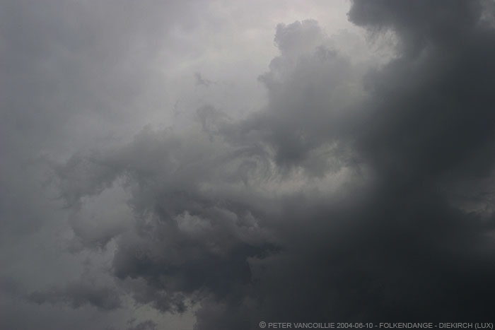
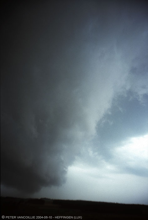
Small, cigar-like anvil in the south west.
Mind the speed of how things develop from here on: exif time is 15h26'50"

15h28'36": less than 3 min. after the photo above
15h31'18": again less than 3 min. interval
15h32'22": zoom on right hand side (towards the north-northwest)
15h34'58": less than 3 min. interval (the yellowish part in the middle is probably due to a rain drop on the lens)
15h32'27": zoom on the left hand side (towards the south)
15h33'59": left hand side again, one minute and a half later
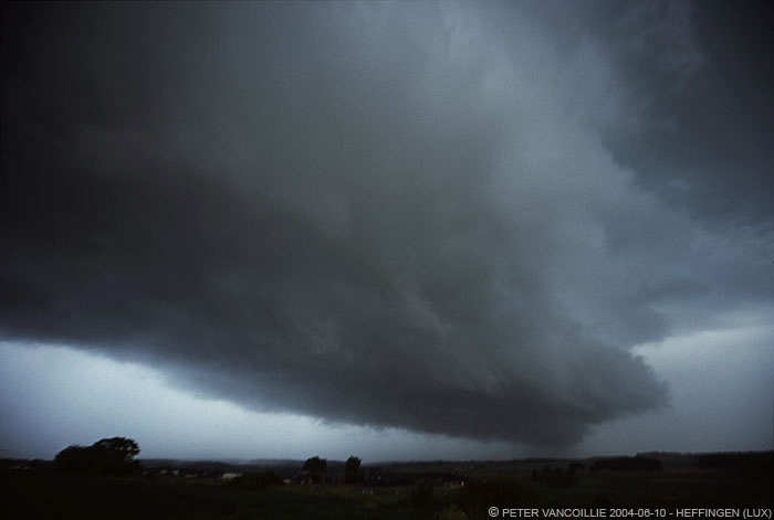
15h35'05": nine minutes after the first photo:
trying to escape it is no longer an option ;-)
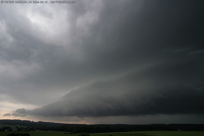
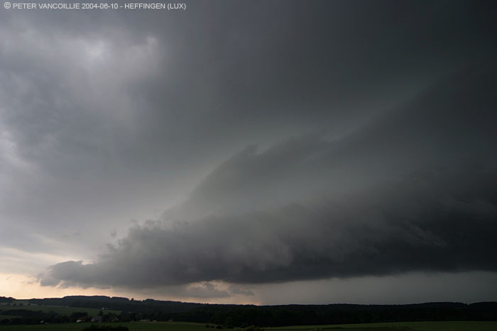
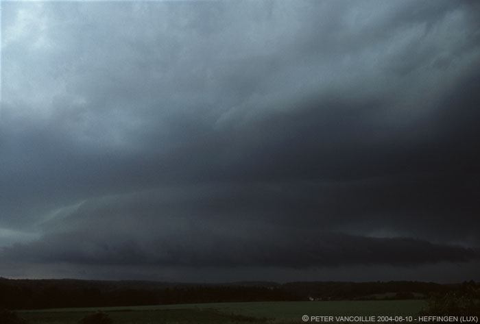
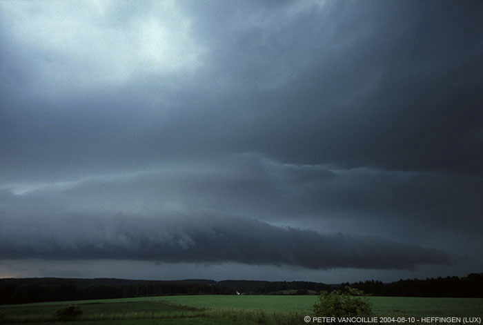
Below are some slide scans of the same events. Colours are different due to different glass in lenses, provia slide film instead of digital etc etc. And besides that, these images too needed a lot of enhancement. I'm not very familiar yet with my new 12-24mm sigma. Getting the right exposure if things go this fast is not easy.
Too dark but I was concentrating on the nice features of the upwards pushing shelf at the left of the picture
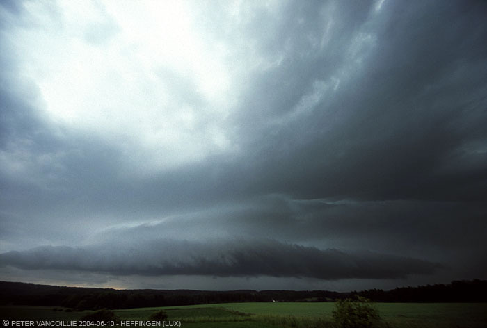
Shelf at its maximum to our right hand side (view towards north)

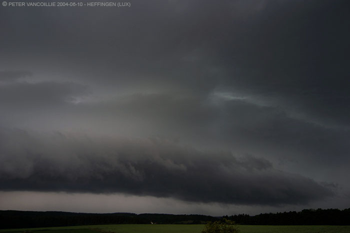
Shelf at its maximum to our left hand side (view towards south)
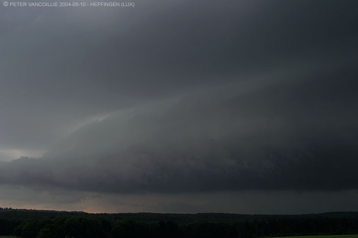
Last image (right again) before we got battered for the second day in row
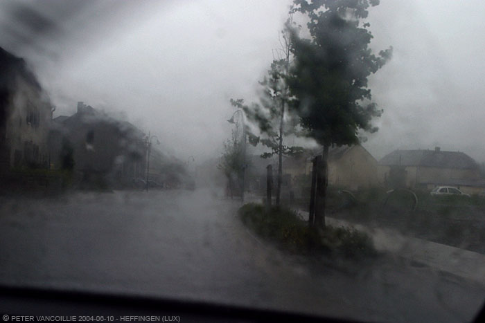
heavy rain and hail up to 1.5cm, but surprisingly short
View to the back of the system: inflow comes from the right hand side (SW),
small mammatus clouds hang down from the anvil

Hard transparent hail with a small white nucleus which must have been about 2cm diameter originally
Below a crop of the above image
T - Technical
- Camera: Canon Eos 10D
- Lenses: Canon EF 28-105mm F3.5-4.5
- Lenses: Canon EF 75-300mm F4.5-5.6
- Lenses: Sigma 12-24mm F4.5-5.6
- Settings per foto vind je in de exif regels
Photos Olivier:
- Camera: Canon Eos 1v
- Lenses: Sigma 28-105mm F2.8
- Lenses: Canon EF 75-300mm F4.5-5.6
- Lenses: Zenitar MF 15mm fisheye
- Agfa RSX ISO 50; FUJI PROVIA ISO 100